Aerial Cinematography Has Been Around Longer Than You Think…
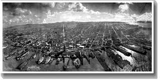
As far back as the early 1900’s, handheld cameras were used to make films in helicopters. Today, it’s altogether common for people who take an air tour to naturally capture gorgeous video footage and pictures of their favorite sites.
In previous blogs we’ve shared some facts about the history of helicopters, and female helicopter pilots – so now, let’s take a peek at the interesting world of aerial photography!
The Vast History (Greatly Condensed!):
Aerial photography (or airborne imagery) is the taking of photographs from an aircraft or other flying object. Platforms for aerial photography include fixed-wing aircraft, helicopters, unmanned aerial vehicles (drones), balloons, blimps, dirigibles, rockets, pigeons, kites, parachutes, and stand-alone telescoping and vehicle-mounted poles. Mounted cameras may be triggered remotely or automatically; hand-held photographs may be taken by a photographer.
Aerial photography should not be confused with air-to-air-photography, where one or more aircraft are used as chase planes “chase” and photograph other aircraft in flight.
Aerial photography was first practiced by the French photographer and balloonist Haspard-Felix Tournachon in 1858 over Paris, France. However, the photographs he produced no longer exist and therefore the earliest surviving aerial photograph is titled ‘Boston, as the Eagle and the Wild Goose See It.’ Taken by James Wallace Black and Samuel Archer King in 1860, it depicts Boston from a height of 630m.
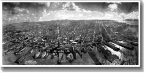
Antique postcard using the “kite photo” technique. (circa 1911)
Kite aerial photography was pioneered by British meteorologist E.D. Archibald in 1882. He used an explosive charge on a timer to take photographs from the air. Frenchman Arthur Batut began using kites for photography in 1888, and wrote a book on his methods in 1890. Samual Franklin Cody developed his advanced ‘Man-lifter War Kite’ and succeeded in interesting the British War Office with its capabilities. Records of balloon photography followed soon thereafter…
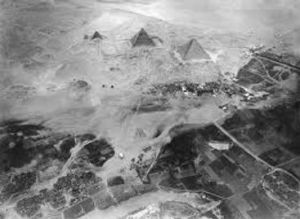
Eduard Spelterini’s balloon image circa 1904
The first use of a motion picture camera mounted to a heavier-than-air aircraft took place in 1909, over Rome in the 3:28 silent film short,”Wilbur Wright und seine Flugmaschine”.
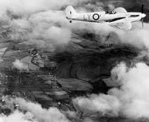
In 1939 Cotton and “Flying Officer Longbottom” of the RAF were among the first to suggest that airborne reconnaissance may be a task better suited to fast, small aircraft which would use their speed and high service ceiling to avoid detection and interception.
From that point forward, additional strides have been made to take us from those very first “kite” attempts at capturing photos, to simply aiming and pressing an icon on our phones!
World War I:
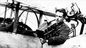
The use of aerial photography rapidly matured during the war, as reconnaissance aircraft were equipped with cameras to record enemy movements and defenses.
- At the start of the conflict, the usefulness of aerial photography was not fully appreciated, with reconnaissance being accomplished with map sketching from the air.
- The French began the war with several squadrons of Blériot observation aircraft equipped with cameras for reconnaissance. The French Army developed procedures for getting prints into the hands of field commanders in record time.
- Frederick Laws started aerial photography experiments in 1912, taking photographs from the British dirigible “Beta”.
- Germany adopted the first aerial camera, a “Gorz”, in 1913.
- In 1916 the Austro-Hungarian Monarchy made vertical camera axis aerial photos above Italy for map-making.
The Varied Uses:
Cartography (surveys, topographic mapping, archaeology, environmental studies, power line inspections) surveillance, commericial advertising, artistic projects, movie production, agricultural studies, military information gathering, and more.
The Many Platforms:
Helicopters, fixed-wing craft, drones, small-scale model aircraft, hot air balloons, blimps.
Interesting note: In the United States, except when necessary for take off and landing, full-sized manned aircraft are prohibited from flying at altitudes under 1000 feet over congested areas and not closer than 500 feet from any person, vessel, vehicle or structure over non-congested areas. Certain exceptions are allowed for helicopters, powered parachutes and weight-shift-control aircraft.
Radio-controlled model aircraft:
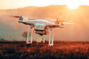
Small scale model aircraft offer increased photographic access to these previously restricted areas. The use of RC helicopters as reliable aerial photography tools increased with the integration of FPV (first-person-view) technology. Many radio-controlled aircraft are now capable of utilizing Wi-Fi to stream live video from the aircraft’s camera back to the pilot’s or pilot in command’s (PIC) ground station.
The Styles:
- Oblique:
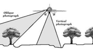
Photographs taken at an angle are called oblique photographs. If they are taken from a low angle relative to the earth’s surface, they are called low oblique and photographs taken from a high angle are called high or steep oblique.
- Vertical:
Vertical photographs are taken with the camera pointing straight down, as opposed to oblique photographs which are taken at an angle. They range from a simple ‘spot image’ to aerial surveys of large areas. The choice of lens and altitude determine the resolution of the resulting photographs.
- Combined:
Aerial photographs are often combined. Depending on their purpose it can be done in several ways. Here are a few examples:
-
- Panoramas can be made by “stitching” several photographs taken in different angles from one spot (e.g. with a hand held camera) or from different spots at the same angle (e.g. from a plane).
- Stereo photography techniques allow for the creation of 3D-images from several photographs of the same area taken from different spots.
- In pictometry, five rigidly mounted cameras provide one vertical and four low oblique pictures that can be used together.
- In some digital cameras for aerial photogrammetry images from several imaging elements, sometimes with separate lenses, are geometrically corrected and combined to one image in the camera.
- Orthophotos (photographs which have been geometrically “corrected” so as to be usable as a map) are commonly used in geographic information systems, and are a simulation of a photograph taken from an infinite distance, looking straight down. Perspective must obviously be removed, but variations in terrain should also be corrected for. Multiple geometric transformations are applied to the image, depending on the perspective and terrain corrections required on a particular part of the image.
With advancements in video technology, aerial video is becoming more popular. Orthogonal video is shot from aircraft mapping pipelines, crop fields, and other points of interest. Using GPS, video may be embedded with meta data and later synced with a video mapping program.
